Uncategorized

But At Least It’s Not a Dry Heat…

I needed to make it to Katy, TX, in time to have dinner with my (ex) sister-in-law and her husband today and since I was looking at about a 500-mile ride, I knew I needed to (as my dad used to say) “get my rear in gear.”

I set my alarm for 6:20, had the bike loaded and the SPOT started when I swung my leg over the seat at 6:44.  It was a short ride to McDonalds for an Egg McMuffin and a thermos of coffee.  I left McDonalds at 7:10 and was on the road to watch the sun come up at 7:16.

P1060187

A sight I don’t see very often!

I got a few more “shadow” shots:

P1060191

but missed the shadow!

It had been 69 when I left the motel, and an hour later it was up to 80.  I had a few stretches of highway where there gusty winds, but it was never too bad.  By the time I got to San Antonio, the temperatures were up into the high-90s and by the time I got around the Loop it was up to 102.  After I got out of San Antonio, it went back down to 99 for a while, but when I got here, it was 105.  I took a break at a rest area about 70 miles west of here.  From a distance, Dudley doesn’t look as bad as he does up close.  🙂

P1060198

Stats:  Day, 495 miles; Trip, 11,495 miles; Year, 17,303 miles; Total, 69,391 miles.

Tomorrow I’m heading toward Baton Rouge where Tim Wilke, a fellow-moderator of the NT-Owners Forum is set up to do an oil and filter change for me.

Chuck Frank, a member of the NT-Owners Forum known there as Chuck 500, joined us for supper and by the time he rode “The Horse With No Name from downtown to Katy, his thermometer was reading 110.


Categories: Uncategorized | 6 Comments

A Long Short Day

Four Corners Tour, Day 8; Epic Ride, Day 28:

When I hit the road this morning, I knew I was going to lose an hour to a time change.  I was wrong; I lost two hours!  And on the western side of the Central Time Zone, it gets dark earlier.  I had planned on going to Sonora, TX, before stopping for the night, but it was dark when I got to Fort Stockton and I could see the Motel 6 from the gas station, so I checked in, got a meal, and am getting ready to go to bed.

The only time I’ve driven the highway between San Antonio and El Paso it was at night until we stopped in Van Horn.  It’s all a lot prettier than I had expected so I don’t want to miss more daylight.

I’m going to hit the road at 7AM in the morning to make it to my ex-sister-in-law Kathy and her husband Bob’s house in time for us to go out for Mexican food tomorrow.  515 miles to go, but I’ll start earlier, grab lunch to eat as I ride and save time in general.

A few pictures from today:

P1060151

Southern Arizona with a UP coal train being passed.

P1060156

That may look like water in the distance in front of the mountain, but it’s not.  It’s sand.  There were warnings all through New Mexico about blowing dust reducing visibility to nil; but my winds were light.

P1060162

West Texas (east of El Paso)

P1060164

P1060168

Shadows

P1060166

An abandoned building near Balmorhea

P1060178

Sunset over my shoulder

P1060173

Stats:  Day, 514 miles; Trip, 10,934 miles; Year, 16,807; Total, 68,895 miles.

Categories: Uncategorized | 2 Comments

The Best-Laid Plans of Mice and Men…

For months my NT-riding buddy Rick Ryan and I had been planning to do the Epic Ride together.  But just before the NT/ST-Owners Rally in Spearfish, Rick started having serious family issues.  These required him to abandon the Alaska part of the trip, which opened the door for Jim Rau to ride with me through Canada and Alaska.  We had a great time and managed to adjust to two radically different personal circadian rhythms.  Jim’s a quick-starter in the morning.  I, to put it mildly, am not.  But we handled it.

When Jim left Prince George, he headed home to Wisconsin.  Rick got back to his home in Henderson, NV, on that same Friday that Jim and I rode to PG.  After a quick packing job and a night’s sleep, Rick left Henderson and rode to Baker, OR, on the day I was riding from Prince George to Blaine, WA.  He joined me in Blaine on Sunday evening a week ago.

We rode Leg One of the Four Corners Tour together, but got separated in one of the Freeway Crawls yesterday.  When I got to the hotel after collecting the Corner at San Ysidro, I could tell he wasn’t feeling good at all.

When we woke up this morning, he said that one of the things he’d learned when he was taking flying lessons was that if something didn’t feel right, you ought not to be doing it.  Even thinking about doing the CC-50 didn’t feel right to Rick, and neither did riding farther away from home than he was this morning.  He said that his ego was telling him to go but his gut and his brain were telling him that he didn’t have it in him to go any farther.

I really appreciate Rick’s integrity and judgment in choosing to terminate his part in the Ride today instead of cratering somewhere on the causeway above the Atchafalaya Basin in Louisiana (for instance).  He made it home, but it took him way longer than it should have and he considered stopping for the night in Baker, 85 miles from his house.

I left SD at about noon, stopped for a late breakfast that included a burrito at a Carl’s Jr, east of San Diego, and then rode on through the mountains to the Imperial Desert and then into Arizona at Yuma.  The temperatures were a balmy 105-110F, but the winds were light and one of the things I learned from Rick (and had confirmed by Kurt Worden, a long distance rider who had witnessed the start of my now-abandoned CC-50) was to ride with LD Comfort long underwear and with all the vents to my Aerostitch Roadcrafter riding suit closed.  The LD Comfort gear is a two-layer wicking material that keeps your skin totally dry and all the sweat you have goes to the outside.  Air comes up the open cuffs of the ‘Stitch arms, hits the sweat (or water if you pour it up your sleeves and instantly creates a micro-climate inside the suit.  You can actually be cool in 110.  You can get the water onto the outside of the LD Comfort stuff by pouring it up (or down) your sleeves and your neck or by drinking it and sweating it out.  I did both today, drinking about two liters of water between the start of the Imperial Desert and Tucson.  The temperature stayed above 100 until about an hour after sundown.

I’m staying at another Motel 6.  This one is only $39.99 for a senior.  Motel 6’s are another good legacy that Rick passed along to me.

I’m going to ride somewhere into Texas tomorrow so I can get to Katy and visit Kathy and Bob Harvey Tuesday night.  Kathy’s my ex-wife’s sister and she and Bob are great friends.  Plus, when we’re together, we almost always manage to find the best Mexican food on the west side of Houston.

On Wednesday, I’ll get to Baton Rouge, where an NT-Owner’s Forum member will set me up for an oil and filter change.

I’ve ordered a GPS that will be waiting for me at my brother Mike’s house in South Carolina next week.  Navigating from here to Florida isn’t too challenging.  I made the only turn when I merged from I-8 onto I-10 (although I guess I’ll do a stint on I-12 east of Baton Rouge).

A few pictures:

P1060118

P1060127

P1060131

P1060141

Stats:  Day, 457 miles; Trip, 10,420 miles; Year, 16,280 miles; Total for bike, 68,372 miles.


Categories: Uncategorized | 5 Comments

Two Down; Two to Go

Four Corners Tour Day 6, Epic Ride Day 26

P1060106It took six days, but I checked off another Corner of the Four Corners Tour today.  This one was the Post Office in San Ysidro, California.  To get there you ride to Exit 1 of Interstate 805, turn right and go up San Ysidro Blvd for about a mile.  To claim the corner, you have to get a picture of a recognizable landmark (Post Office, Police Station, or a few others that the Southern California Motorcycle Association recognize in each of the “Corner” towns), a gas receipt that shows the date, time, and location on a computer-printed form, and record your odometer reading.

P1060104

After San Ysidro, I visited Kurt Worden, a fellow member of the Long Distance Riders List, who had graciously printed out the documentation needed for what we’ll be starting tomorrow.  We’ll be attempting what the Iron Butt Association calls a CC-50 (Coast to Coast in 50 hours or less).  It’s not as crazy as it sounds.  And we’re not deeply committed to anything but getting across the country reasonably quickly and completely safely.  Believe me, I’d rather do 1,000 miles on an Interstate than ride 200 miles on California Freeways like they’ve been the last three days!

Kurt did a CC-50 back in March on a Kawasaki Ninja 250.  That’s a bike with an engine less than half the size of our NT700Vs, and many people don’t believe that the NT is “big” enough to ride for long distances.

Kurt also pointed out that I’d forgotten to start my SPOT tracker this morning.  Sorry ’bout that.  But believe me, you didn’t miss much because Rick and I had more opportunity to do the California Freeway Crawl and it finally became so frustrating that we were enticed into trying lane sharing.  He did better at it than I did.  After a few minutes I gave it up and he disappeared down the road.  Of course, he did have a pressing biological need that I didn’t share, so he was more motivated.

After we were separated, he came on straight to the hotel and missed San Ysidro and meeting Kurt.

Tomorrow, it’s eastward ho!

Stats:  Day, 211 miles (for me); Trip, 9,963 miles; Year, 15,860 miles; Total on Bike, 67,915 miles.


Categories: Uncategorized | 2 Comments

The not-quite-so-supercali… part of the day


We came down a steep and winding CA-154 into Santa Barbara, having enticing views of the city and the sea.  We got onto US-101, looking forward to fast freeway miles spinning out from under our wheels.

By the time we got onto the 101 and into Santa Barbara, we could tell that we were going to wake up in a new world.  Palm trees were everywhere, architecture consisted mostly of red tile roofs and stucco.  The ocean was still blue and we could see the oil-production platforms offshore.

But then, with no warning, the fast-flowing traffic stopped.  And it crawled for 13 miles, with no discernible explanation.  Occasionally, it would get up to 20-25 mph, but then it would stop again.  For over an hour, we crept along, just keeping our focus on staying upright and uncrushed.  Finally, we did get a chance to enjoy freeway speeds for the last 20 miles or so to the motel.

Stats for the day:  Day, 300 miles; Trip, 9,752 miles; Year, 15,608; Total, 67,697 miles.,

BTW, I want you all to know how much I appreciate your comments and suggestions.  BUT we are on the clock and don’t have unlimited time.  So, I’m not skipping sleep to reply to each of you.  I am really glad to have you all along for the Epic Ride.  I value your company as much as I do that of my two great riding partners, Jim Rau and Rick Ryan.  I appreciate them almost as much as I do my loving and supportive wife back in Fort Morgan.  Thanks, Joanne!

Categories: Uncategorized | 4 Comments

A Supercalifragilisticexpeali…

….docious Day… In other words, another very good day!

As we left Salinas this morning, I was immediately impressed with the agricultural abundance of this part of California.  They’ve got some big people growing our crops:

P1060010

We had our first stop-and-go experience of the day as we rode through Monterrey.  For a couple of miles, traffic on both sides of the road wasn’t moving faster than a few feet a minute.  Our first two hours took us down the coast only 70 miles.

But when we got clear of Monterrey and Carmel-by-the-Sea, things opened up.  Compared to the coast north of San Francisco, the road is in better shape and has fewer of the 15mph corners that bugged me so much on Wednesday night and Thursday.  The highway was more “sweepers” than “twisties,” and we all moved along at the same speed, about 5mph under the limit.

We saw a couple of lighthouses:

??????????????????????

Point Lobos and:

P1060050

and Piedras Blancas near San Simeon and Mr. Hearst’s castle (which we did not see).

In between, we had beautiful weather, not too hot, not too cold, and the fog bank was several miles offshore.  We saw some outstanding engineering and construction as we rode through a tunnel being built at a site where the road has been closed on a semi-regular basis due to land- and rock-slides.  When this is finished, that won’t happen again.  Or if it does, it shouldn’t be as bad.

P1060027

P1060029

A little over two hours after we left Salinas we arrived at the Ragged Point Inn and Restaurant, a place that had a magical feel and that we enjoyed for nearly two hours.

The views are amazing, the grounds are very well-tended, the restaurant was excellent, and the atmosphere is laid-back.  How many places with a restaurant will let people bring their own picnic baskets and spread them out on the manicured lawn?

P1060033

Rick, my friend and riding partner, and

P1060036

me, in all my radiant pulchritude.  🙂

P1060042

P1060041

After lunch and just sitting and soaking in the day (the smells were amazing, as were the butterflies, the bees, the flowers, and the begging bird), we went on south to Seal Beach, where we saw… no, you’re wrong — we didn’t see justseals, we saw ELEPHANT seals:

P1060058

Looking at these guys, we decided that they have the kind of retirement many people look forward to, and it made us glad that we were more active.  🙂

P1060072

On down the coast we saw this rock.  If you think you recognize it, you probably can’t remember where it is.  Well, it’s in Morro Bay, California.

P1060084

From there, we went inland and took CA-154, which was just as beautiful as the coast in a different way.

P1060090P1060093

Categories: Uncategorized | Leave a comment

Back near old (very old) stompin’ grounds…

We woke to find very wet bikes, which gave us the chance to do a little cleaning.  My windshield, headlight, and the top of my gas tank (basically what I can see) are cleaner than they were.  When we park, Rick usually finds a different part of the parking lot, because he doesn’t want anyone thinking that his pristine bike associates with a filthy pig like mine.  🙂

But the “wet”  was more mist than fog, so we could see where we were in a monochrome sort of way.

P1050972

The temperature stayed in the low 50’s so I appreciated my electric grips and heated jacket.  Rick appreciated his windbreaker equally as much, I’m guessing.

This coast is near my family and I lived in ’78-’79, when we spent a year living in Santa Rosa while I was “oil-field trash.”  My wife had an MG-B and we had fun driving some of the roads Rick and I rode today.

It was fun riding through Bodega Bay and remembering the day my flight instructor put me under “the plastic cloud” (a device which restricts the student’s vision to the plane’s instruments and is more frequently called “the hood”) and took me out to practice instrument flight and recovery from unusual attitudes.  After we’d done that, he gave me vectors and kept having me descend lower and lower.  When we got down to 100′ AGL, I knew we had to be over the ocean.  Then he took me down to 50′ AGL and removed the hood.  We were just above Bodega Bay, with the town and the cliffs on our left, the headland between the bay and the Pacific and nothing but ocean in front of us.  It was one of my best flying moments.

P1050982

This is a picture of a church in Bodega Bay that may have been the one featured in Alfred Hitchcock’s film, “The Birds.”

We rode along Tomales Bay, which looked like it would have been a great place to sail “Taradiddle,” the wooden 17′ cat-ketch we owned while we lived in California but which never got wet, the whole time we were there.  I confess that I never really considered sailing in Tomales Bay after someone caught a 15′ Great White shark there not long after we moved to Santa Rosa.  But there were lots of boats sailing in the south end of the bay today.

P1050989

After a brief stop in Stinson Beach, we rode up the southwest flank of Mt. Tamalpais and were treated to stunning views of the vastness of the Pacific Ocean.  You could see three or four ships heading west and one coming into port.

P1050993

This was taken just as we started out of Stinson Beach.  I wish I’d gotten better pictures of the ocean, but we would have needed to stop … or I would have taken a plunge into the icy depths.

We came out onto Highway 101 at Sausalito, and were quickly onto the Golden Gate which has made a big improvement in processing traffic — they no longer make you stop and pay a toll.  Instead their cameras record your license plate and I’ll have a bill waiting for me when I get home (unless I can con Joanne into paying it for me).

P1060003

You might be able to guess where this was taken.  🙂

Getting through San Francisco wasn’t as bad as I thought it would be.  We rode through the Presidio and then down Highway 1, right past Calvary United Methodist Church, one of the places where we and a bunch of University of Wyoming kids, along with the Wesley Foundation Director, Bill Bruce and his wife Jean, did a Mission Trip and painted the pre-school back in 1982.

The traffic got us in San Jose and then again about 20 miles south.  We were reduced to a crawl or less.  We got to see what “lane-sharing” looks like, and it was scary.  A couple of times, when we were moving at close to 60mph, a guy on a crotch rocket blasted past us and then through the moving traffic at 75-80mph.  A couple of other times, we were barely moving and a guy on a crotch rocket blasted by us and through the traffic at 50-60mph.  The only person who seemed to be doing lane-sharing the way I thought it “ought” to be done was a man on a Goldwing, moving about 10mph faster than traffic which was moving at 15-25mph.  I was slightly tempted to follow him.  But not enough to do it.

Stats for Day 4 of the Four Corners Tour and Day 24 of the Epic Ride:

Day, 296 miles; Trip, 9,452 miles; Year, 15,305 miles; Total, 67,393 miles.


Categories: Uncategorized | 1 Comment

Epic-er and epic-er….

Four Corners Tour, Day 3; Epic Ride, Day 23:

We are in Fort Bragg, CA, after riding some more magnificent roads.  The first part of today’s ride was on a road I used to look at from the air as I’d fly to Oregon in Cessna 172s.  It’s CA-96, the Klamath River Road.  The longest straight stretch might have been a half mile.  It was downhill all the way from where we got on just north of Yreka to Erreka, the other “reka” in California, so we got 248 miles out of the tank, a new record for Rick, even though we did about 40 miles  on I-5 between Ashland and Yreka at 70mph.

The Klamath River is a national wild and scenic river and the pavement was in mostly good shape, although we had to stop for a couple of construction sites.  We rode to Happy Camp and took a quick break and then rode non-stop to Eureka, where we got gas.  It had been smoky all the way from Yreka to Happy Camp, and while we were stopped there it got significantly worse, but as we went on west, it got better.

Getting out of Eureka was an ordeal, but just a bit out of town, the traffic got light and we moved right along till we got to Legget, where we took CA-1 to the coast and to Fort Bragg.  It was extremely technical, getting darkish, coolish, and very, very interesting.  Lots of ups and downs, curves ranging from 15-30mph, and then a good view of the coast after about 22 miles.

We got here and the restaurant on the motel parking lot had already closed but we found a great Italian hole-in-the-wall in a strip mall behind the Motel 6.  They’d closed already, but the chef told us what he could serve us and we got an outstanding meal with no pressure to hurry.  If you’re in Fort Bragg and have a hankering for Italian food go to D’Aurelios’s at 438 Franklin Street and tell them we sent you.

Tomorrow we’ll end up in Salinas, about 10 miles from Monterey.

Some pictures:

P1050955

About half way between Yreka and Happy Camp.

P1050958

P1050964

Amongst the redwoods on 101.

P1050968

The Spacific Coast north of Fort Bragg;

P1050971

Too bad I didn’t get the picture of the sunset I saw about two minutes before I took this.  It was much more colorful and had ocean and everything.  At least I got a picture.
Stats:  Day, 336 miles; Trip, 9,156; Year, 15,005; Total, 67,093.

Tomorrow we’ll end up in Salinas, about 10 miles from Monterey.


Categories: Uncategorized | Leave a comment

One Down, Three to Go…

Rick joined me Sunday night after doing a two day ride from his home in Henderson, NV.  We got up on Monday morning, loaded up, got our beginning pictures documenting the first corner in Blaine:

P1050900

The International Motel, a friend of Four Corners Riders and

P1050901

and the Blaine Police Department (while Rick was taking the picture, an officer pulled up with his lights flashing… but he wasn’t after me for being parked in a no-parking zone; he was stopping a scofflaw of some sort).

We rode down I-5 a ways and then went to Annacortes and Whidbey Islands, passing NAS Whidbey.  The entrance is marked by two Grumman A-6s.  Jim and I had talked (during a wait for a construction pilot car east of Tok on our way out of Alaska) to a man who had maintained the radar and computers on one of them when he’d been in the Navy.

P1050903

We made it to the ferry and had about a half-hour wait till it came in.  Motorcycles are first on and almost first off.  This was the motorcycle gang:

P1050909

It was foggy all the way to Port Townsend, but cleared off just before we docked.

Traffic from Port Townsend to Port Angeles kept our average speeds pretty low.  And once west of Port Angeles, a law-abiding citizen driving prudently 5mph under the speed limit and ignoring the fact that about 20 vehicles were backed up behind him and the fact that signs said that having more than 5 vehicles slowed down required you to use the turnouts thoughtfully provided by the National Park Service, kept us very slow.  It wasn’t till Forks, that we began to be able to move at the speed limit.

We rode near the coast for a bit and were in fog and temperatures that got down to 48F.  I got chilled and when we stopped at Hoquiam, I put on my heated jacket and used it all the way to Warrenton, south of Astoria.

We found a great seafood place, Doogers, and enjoyed supper before going to the KOA a few miles west of there and being ripped off.  We were charged $50 because the space we were assigned had water and electricity.  What it didn’t have was enough grass to be able to put two tents on it.  Oh, well… it was late and we were glad to get to bed.

Stats for Monday:  Day 1 of the Four Corners ride, 402 miles; Trip, 8,400 miles; My mileage for the year, 14,238.  My total mileage, 66,237 miles.

Day 2 of the Four Corners Ride:

We rode down to Seaside, ate breakfast at McDonalds (Rick and I are 2 for 2 now on that score), got gas and headed south.  I tried to take us to a beach where my first wife and I and some friends were robbed back in 1986, but missed a turn and instead took us on a slow tour of Cannon Beach… the town Cannon Beach, not the beach Cannon Beach.  All the way down to south of Tillamook, where we didn’t try any cheese or go to the Aviation Museum, we crept along.  By that time, we’d decided that while the Oregon coast is beautiful, we only have 19 days remaining to get to Madawaska, Maine, and the Oregon Coast isn’t that beautiful.

We left the coast at Hebo, and took a great road to Salem.  Then we hopped on I-5 and proceeded to cook.  The temperature was in the high 90s and hit 100 for a few minutes.  Scenery went away as we went south because of smoke from forest fires.  Between Grant’s Pass and Medford visibility was down to less than a mile.

When we got to Ashland, we stopped to try to confirm that the campground I ad in the GPS as our destination actually had campsites available.  We couldn’t do that because they wouldn’t answer their phone.  So rather than strike out down the Klamath River Road, CA-99 (a road I used to study from the air as I flew to Oregon back in the day when I worked for Drilco and could fly myself around on business), we called Motel 6 in Yreka, and got the assurance that they’d keep the light on for us.

So that’s where we are.  Motel 6, Yreka, CA.  Tomorrow, it’s the Klamath River Road to Arcata and Eureka.  We’ll get on CA-1 at Leggett, and follow the northern California coast to Mt. Tamalpais and San Francisco.  BTW, I don’t think we’ll get that far tomorrow.  🙂

Stats for Day 2 of the Four Corners Tour:  Day, 420 miles; Trip, 8,820 miles; Year, 14,663 miles;  Total Miles, 66,762.

I’d love to post all the magnificent pictures I took today, but my memory card for the camera was riding along in my trunk, in this computer.  So, I’ll just tell you how great they were.

They  were really, really, REALLY good.

One of the ones I wish I had was a picture of my odometer as it passed a milestone that is (for me) a significant number.  Just south of Roseburg, it turned all sixes:  66,666 miles.

Categories: Uncategorized | 7 Comments

A Long Day’s Journey Into Night

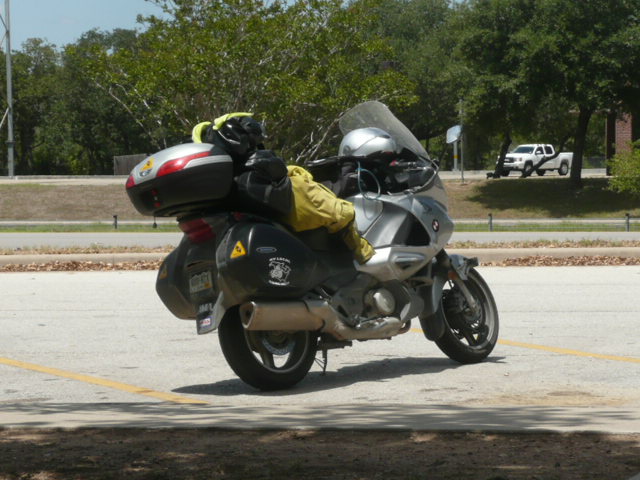
Because of difficulties doing laundry in Prince George, I was later getting away than Jim was as he headed east toward Edmonton, Alberta.  I left the hotel at about 10, had trouble with my left pannier (it came open as I was riding toward breakfast!), then ate a leisurely breakfast at a Denny’s and didn’t get out of PG till close till noon.

I rode south through country that was more agricultural than anything we’d seen except for the 100 miles or so west of Grande Prairie, Alberta, and stopped after 140 miles at a rest area.  I had an interesting conversation there with a bicycle rider heading from Prudhoe Bay to Ushiaia, the southern-most point in South America.  You can check out his location at http://www.whereispaul.me.

A few more miles down the road and I gassed up at 100-Mile House, 207 miles south of Prince George.  Then as I left town, the rain started.  It was never as bad as the rain Jim and I rode in during the leg from Haines Junction and Tok, but was hard enough to keep my attention focused and to make my riding “interesting.”

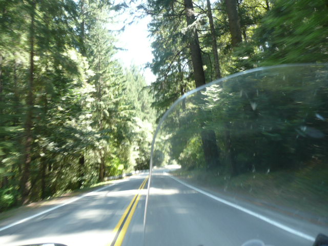
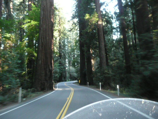
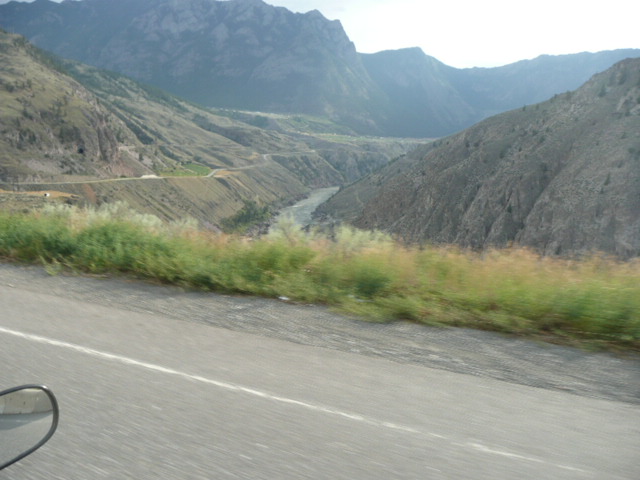
But not long after I turned onto 99, the rain stopped.  Canada 99 is a great and challenging ride.  At first the roads and the terrain reminded me of the coastal mountains and hills of northern California.  But then I started paralleling the gorge of the Frazier River and the dryer country around it, surrounded by towering mountain ranges took on a more primordial feel.

P1050869

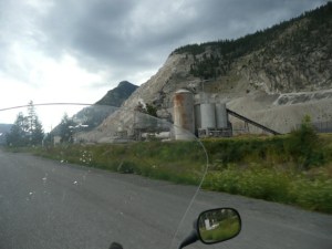
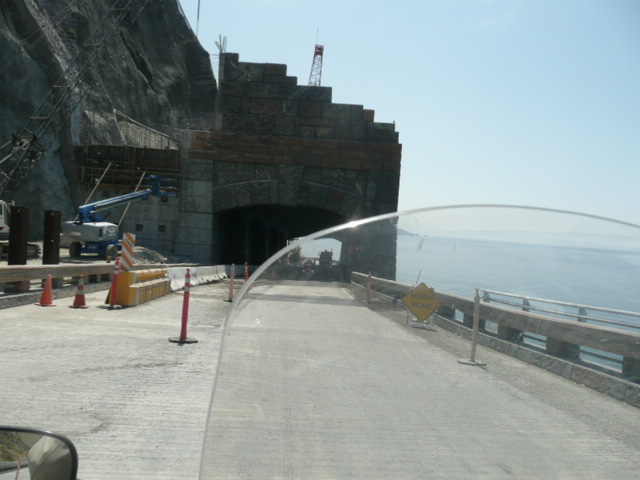
A mining operation on 99.

P1050871

P1050874

There were 13% grades and 20mph hairpins and that was nothing compared to what was coming after Lillooet.

P1050879

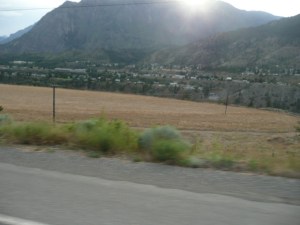
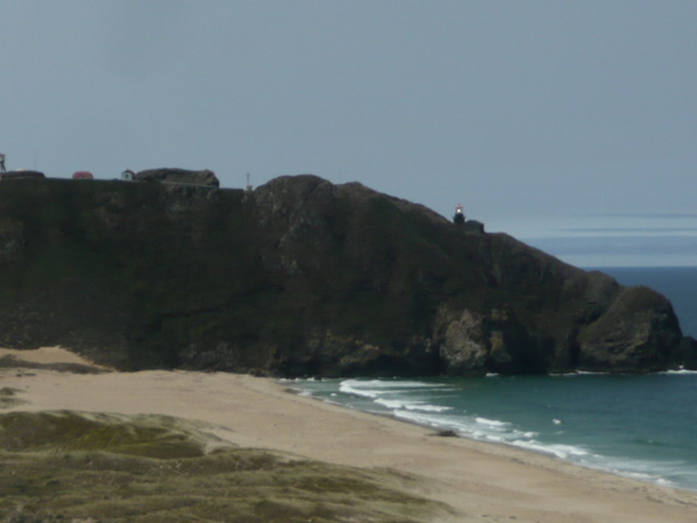
A kind-of-fuzzy view of Lillooet.

I should have stopped there, fuzzy or not.  There’s not much there (although it’s “Guaranteed to Be Rugged” and it definitely lives up to that claim.  But, there probably would have been a motel room.  There sure weren’t any between there and Blaine, Washington!

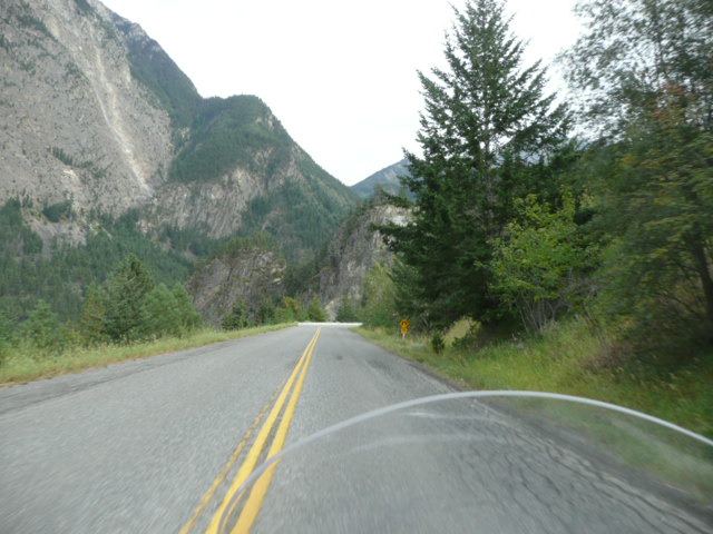
That was OK, because I wasn’t ready to stop at Lillooet anyway.  Out of town the road, such it is, follows the Cayoosh Creek drainage.  It was a road that has me looking for new superlatives and there probably aren’t that many I haven’t already used.  Steeper grades, tighter turns, more and more rugged terrain.  The only road I can compare it to is one that my friends Rick Hall, Chris Baum, and I rode between Gold Beach, OR, and Grant’s Pass.  This road was slightly wider, much better marked, and was missing the 1-200 yard-long cracks that left you wondering if you’d be able to get to the other side of the road if you needed to, but it had that desolate character, only slightly marred by occasional traffic.

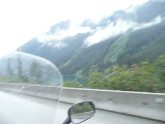
Just as I left Lillooet, a deer walked across the road in front of me and then, just as I started rolling again, there was a guy on a Triumph Bonneville right beside me, hollering something.  I stopped and he told me that the “deer were everywhere!  I’ve seen 12 today!”  He turned off within a half mile and I rode on.  I stopped at a pullout and talked to a railroad engineer who was moving from Vancouver to Lillooet to drive trains for the Canadian National Railroad.  He had a real purty Harley Davidson V-Rod in the back of his purty pickup truck.  Here are some pictures from along the way:

P1050882

P1050884

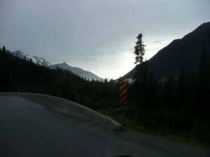
Looking back towards Lillooet.

P1050885

Near the summit where the Cayoosh Creek drainage starts.  I missed some of the best pictures because I had my mind and hands occupied with riding.

P1050891

P1050894

P1050897

The road was only 60 miles from Lillooet to Pemberton, but it took me about an hour and 45 minutes.  I saw another deer, had a close encounter with a beagle pup near the end and got closer to a bear than I’ve ever been.  The bear encounter was one of those “I wish I’d realized what that was” moments.  Just a couple of miles after the beagle ran across the road in front of me, I was clear to the right of the pavement, trying to encourage a pickup to go around me.  There was a concrete barrier immediately to my right and suddenly there was a black, hairy mass sticking up above the barrier.  I realized about 2 seconds after it was behind me that it had been a bear walking along the creek that was about 3′ feet to the right of the barrier.  It had been a big bear, too, even if I didn’t see anything but the top of its head and back.

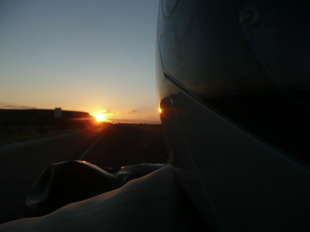
From the time I topped the summit near the headwaters of Cayooshe Creek, it was getting darker and I kept meeting motorcyclists heading east.  I wanted to stop them and tell them that it wasn’t a road I’d be wanting to ride in the dark, or in the hour or so leading up to the dark.  Deer-thirty, I thought.

When I got to Pemberton, I’d decided that I’d stop at the first motel I saw.  Well, Pemberton isn’t that kind of town.  No motels at all.  Lodges and condos.  All full.

The girl at the lodge I stopped at told me that she already knew everything in Whistler was full and suggested that I would probably need to go to Squamish, Squamish was another 54 miles.  I would have stopped at campgrounds, but they were all full, too.  When I got to Whistler, I stopped for gas and called ahead to Squamish and learned that everything there was full.  Something about a logger’s festival in Whistler.

So I forged on, in the dark, on winding roads with many fast drivers going both directions, thinking about the deer that were probably out there in the dark, just lurking for a tired Colorado motorcyclist unfamiliar with where he was going.  Those thoughts were enough to keep me focused and riding carefully.

Finally, I got to Vancouver.  Well, North Vancouver.  I got off the by-then 4-lane divided highway and headed into civilization, stopping at the Travelodge that was the first motel I could turn into.  That’s when I learned that everyone in Canada was on the move due to a long weekend.  There would be no motel rooms in Vancouver.  I tried calling towns east of Vancouver, but as far back as Abbotsford, the story was the same.  Nothing.  Zip.  Nada.  Everything was full.

So, I used my GPS to give me a phone number to call from a Denny’s in North Vancouver.  I called the International Motel in Blaine, the destination I thought I”d reach today, and there was one (smoking) room still available.  The man said he would hold it for me and didn’t take a credit card number to reserve it.  It was nearly midnight then, and I told him I was going to get something to eat and then it would take an hour to get to him.  He said that was OK.  I ate my 2nd meal in a row at a Denny’s and thought I’d be here by 1:30 or so.

I was within a mile by that time, but then it took me an hour and 45 minutes to get through Customs.  The line was two cars wide (which were merging into one line about 400 yards from the SINGLE lane that was open for customs clearance.  I was to the point where I was sure I was going to drop the bike again by the time I got up to the not-too-friendly customs office welcoming us all to the USA.  Plus I dropped my passport when he handed it back to me.  He wasn’t happy about picking it up, but decided that it would be quicker than watching me get off the bike and pick it up and then get back on.  And he’d never even seen me get on and off the bike.  🙂

The traffic pattern leaving Customs was confusing and tight and by 3:45 my bike-handling skills were even worse than usual.  I wasn’t sure I was going to make it out and cover the remaining 200 yards to the Blaine exit.  But I did and
when I got here, to the International Motel, the manager gave me a non-smoking “suite” of two bedrooms.  Simple but clean and only $49/day.  I told him this morning that was going to stay another night and he told me that since I’d gotten here so late he figured the room was mine till Monday anyway.  Then I told him Rick was going to join me for the Four Corner’s Ride and he told me that he always liked to give Four Corners riders a break (“Just don’t tell Edith!”), so even though he usually charged $72 for two people in a two room unit, he’d let Rick stay for free.  “Just don’t tell Edith!”

I slept for about 5 hours and then my phone started making noise at me.  Text messages from people.  I should have left it off.  I got up, walked down the street, and had a good breakfast, and now that I’ve updated the blog, I’m going back to bed till Rick gets here.

Stats:  Day 21:  556 miles; Trip, 7998 miles; Total for Year, 13.842 miles; Total on bike, 65,931 miles.

Categories: Uncategorized | 5 Comments

Blog at WordPress.com.