Monthly Archives: August 2013

Lunenburg, Nova Scotia…

Epic Ride, Day 50

…is a town deeply rooted in its seafaring past.  So deeply rooted that it’s been designated as a UNESCO World Cultural Heritage Site.  And for someone like me who has always loved the sea and the boats and ships that float on it and the men who have taken those ships out into its unforgiving waters, Lunenburg has a powerful attraction.

I’ll be here about 36 hours and I’ll have slept about 16 of those by the time I leave.  If I didn’t have places to go, things to see, and a loose sort of schedule to keep, I”d probably spend another day or two here.

This morning I started with railroading, not seafaring.  I went to the Lunenburg Railway Museum, which commemorates the Halifax and South West Railroad.  The H&SW started in 1901 and with the hilly terrain it covered between Halifax and Yarmouth on the southwestern tip of the country, it wasn’t the fastest train on earth.  Locals called it the “Hellishly Slow and Wobbly.”  Still, 14 hours was faster than boat or horse.

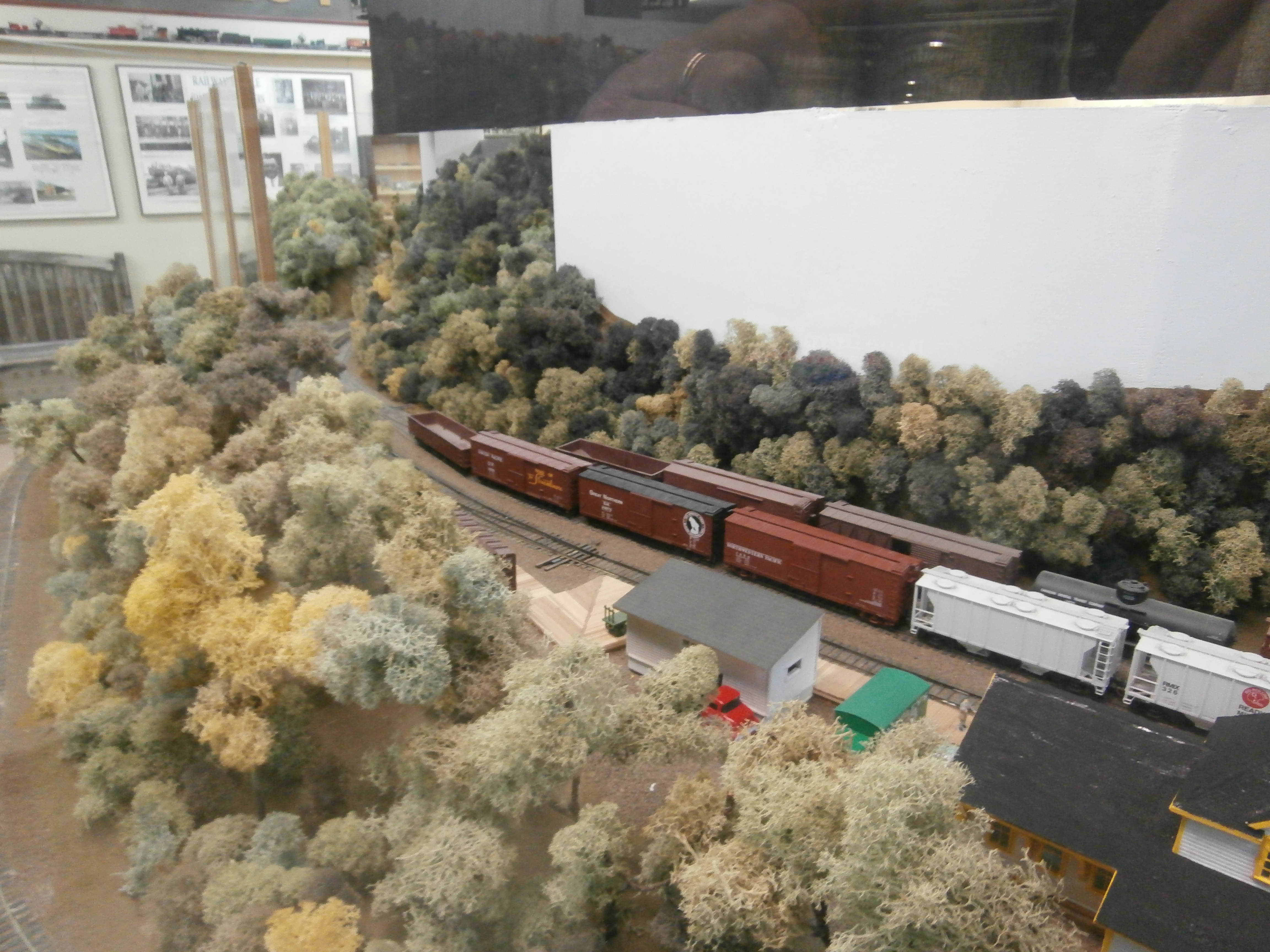
The museum has lots of artifacts and paraphernalia from the old line but it also has the biggest model train layout in Nova Scotia.  The layout is in S Gauge, just like the American Flyer train set I got when I was six.  Most of the major communities along the line have been reproduced with attention to detail and to the historical period represented.  There were four major viewing areas and each of those depicted a different season.

OLYMPUS DIGITAL CAMERA


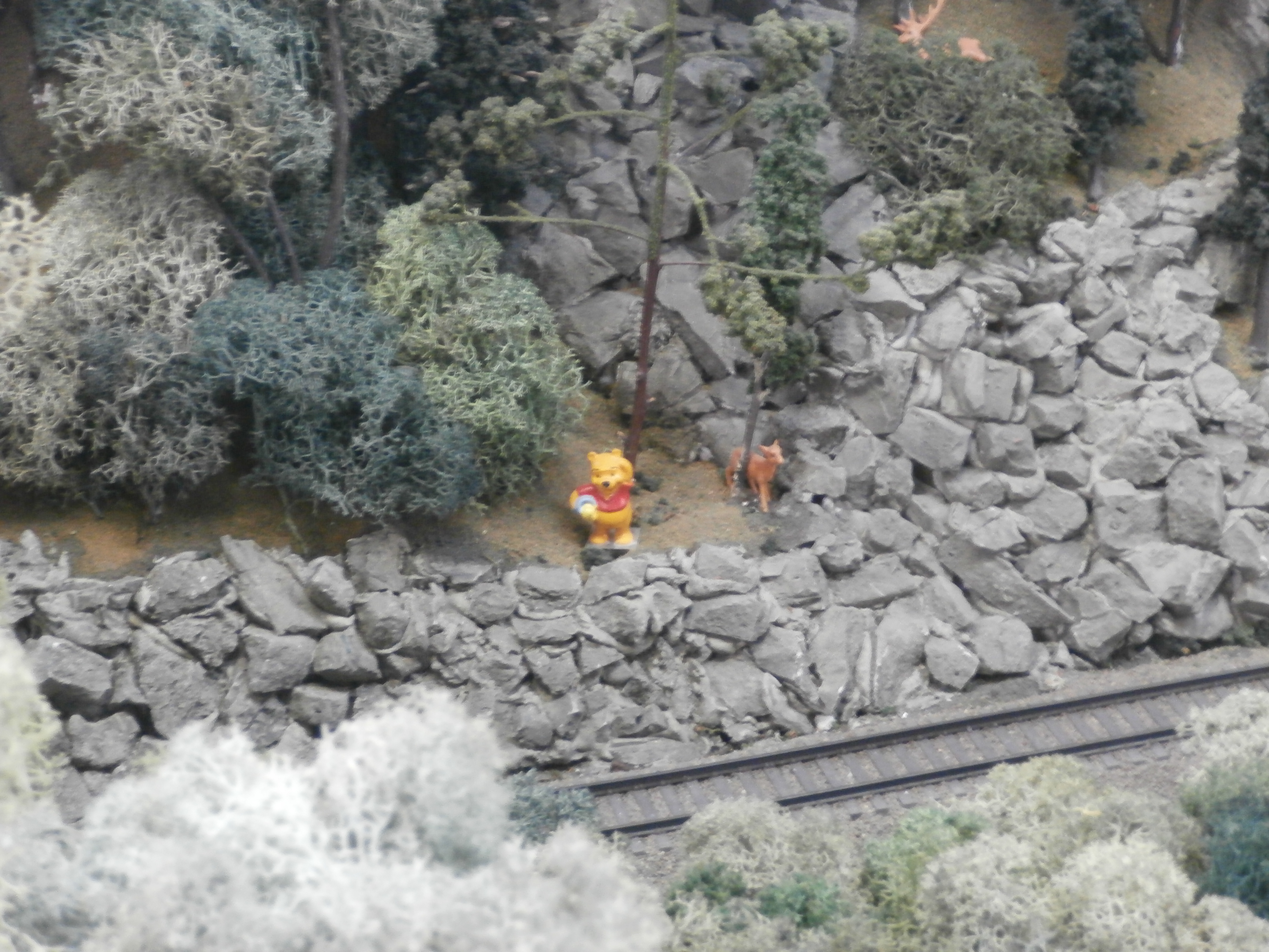
To keep young kids interested in what they were seeing, the model builders have incorporated cartoon characters into the layout:

OLYMPUS DIGITAL CAMERA

The biggest scene depicts Bridgewater, a town about ten miles from Lunenburg, which was the center of the line.  The whole area depicted on the layout and every building in it have all been replaced by the parking lot for a mall!

OLYMPUS DIGITAL CAMERA

When I left the museum, I saw a barber shop and decided it was time to get back to shorter hair.  After getting my ears lowered, I rode down to the waterfront.  As I was parking, there was a sign saying:  “Sail Lunenburg Harbour on the Eastern Star — nest cruise:  12:30.”

Since it was 12:05, I considered the sign a personal invitation and plunked down my $27 to go.  The Eastern Star is a 48′ ketch built in Denmark in 1948.  She’s got beautiful wood and was just refurbished last year.

OLYMPUS DIGITAL CAMERA

Because of her flush decks abaft the main mast, it was easy to fit her with comfortable wooden benches which allow her to accommodate up to 30 passengers.  The wind was breezy enough today that, considering the ages of some of the passengers (there was a 70-year-old man, for crying out loud! as well as some young children), the skipper elected to sail with just the mizzen and the large roller-furling jib.

After we’d sailed out to the edge of the harbor

OLYMPUS DIGITAL CAMERA

and started beating our way back to the dock, the skipper asked if anyone wanted to take the helm.  Well, you know I did!

OLYMPUS DIGITAL CAMERA

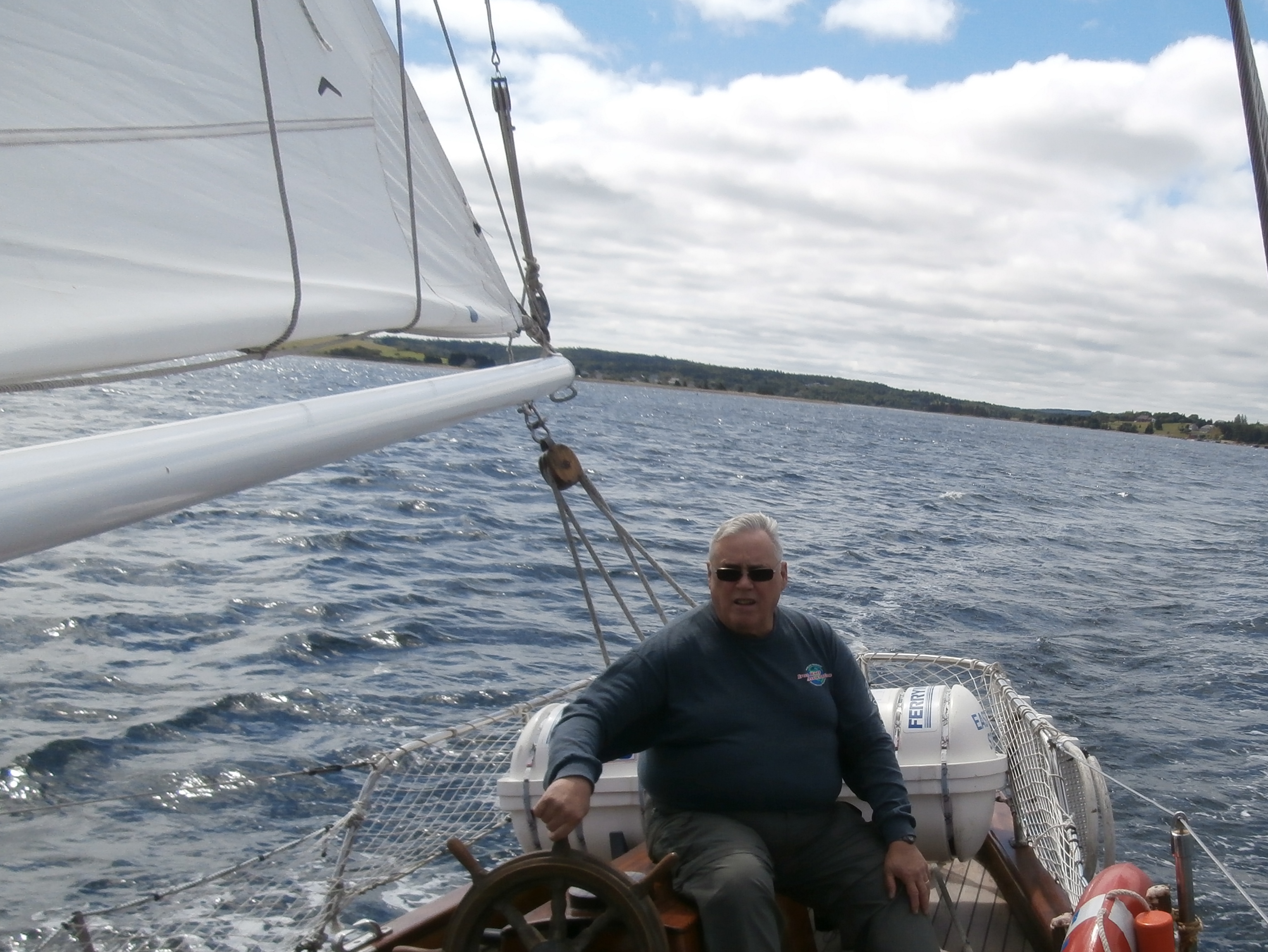
And so did the other kids — a seven-year-old boy and his five- and four-year-old sisters.  The five-year-old was a real natural, but all four of us did a great job!

OLYMPUS DIGITAL CAMERA

As we came back toward the dock, we were able to get a glimpse of the Bluenose II, a replica of the greatest of the Grand Banks fishing schooners and a symbol of Nova Scotia.  The Bluenose was in dry-dock so a glimpse was all we could get today, but she’ll be back in the water this fall.

OLYMPUS DIGITAL CAMERA

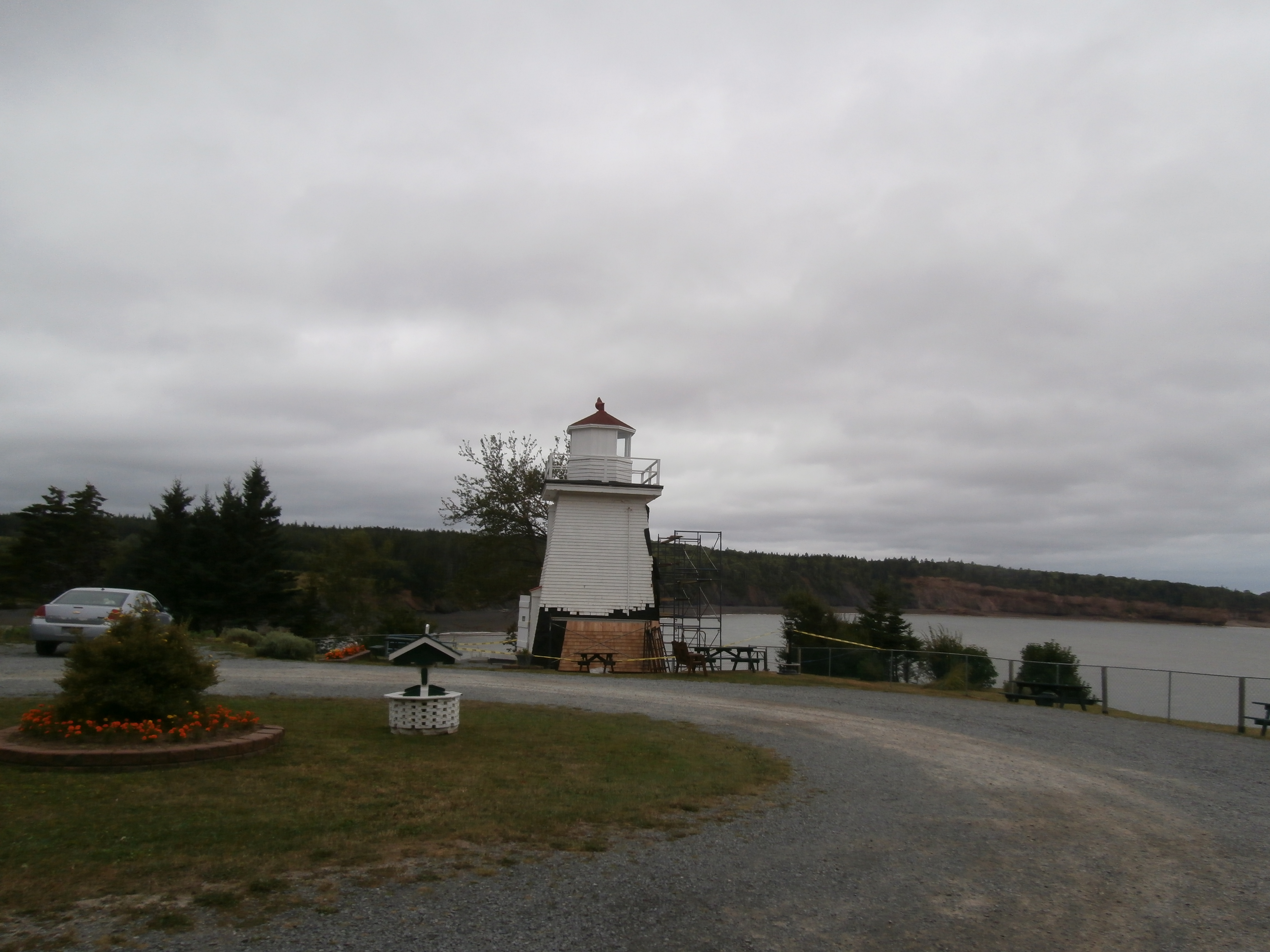
After the sail, I walked around downtown Lunenburg for a while,

OLYMPUS DIGITAL CAMERA

ate lunch, and then headed for the Atlantic Fisheries Museum, housed in the same building where I ate last night, an old “fish factory” and ice house.

The Museum has an aquarium and many great exhibits but the keystone exhibits are floating at the wharf:

The Sable Island, a side-trawler built in Denmark 1962 fished until 1982 when it was replaced by larger and more efficient stern trawlers (which were then replaced by freezer/trawlers, which basically fished the Grand Banks until there weren’t any fish to catch.  And then they were too expensive to operate.

OLYMPUS DIGITAL CAMERA

The other floating exhibit is the Theresa E. Cooper, the last fishing schooner to sail the Grand Banks.  The side-trawler put her out of business.

OLYMPUS DIGITAL CAMERA

Both the Sable Island and the Theresa E. Cooper had ex-fishing captains in their wheelhouses to ask questions and tell you about the boats and their lives afloat.  They were fascinating to talk to.

But the museum closed and I came back to The Wheelhouse, my motel, for dinner and a bit of rest before riding again tomorrow.  After a long walk last night and a day spent climbing up and down ladders, stairs, and steep hills, I was almost (but not quite) ready to dig out my cane!

Tomorrow I’ll head north towards Cape Breton Island and the Cabot Trail.

Stats:  Day, 5 miles; Trip, 16,219 miles; Year, 20,220 miles; Total, 74,196 miles.

Categories: Uncategorized | 1 Comment

Shortest Day

Epic Ride, Day 48:

Today when I woke up at the Maitland Campground, I made the assumption that I wouldn’t have to drive too far to find a place to get that vital first cup of coffee (and a little breakfast).  I was partly right.  It wasn’t very far, but it took longer than I would have expected.  I rode through several communities that were large enough to have names — Densmores Mills, Noel, Tennycape, Walton, Cambridge, and Cheverie — but none of them had any place to get that cup of coffee.  It was 45 miles, and took over an hour before I got to Summerville and then I nearly rode right past the only place I’d see for another 40 miles.  I can’t remember the name of the place, but it was a combination Inn/Art Gallery/General Store/Café that had great food and service at very reasonable prices.

I ended up staying there for two hours, hoping the sun would break through the low overcast to take the chill out of the humid air.  That hope was about as forlorn as my earlier hope for a quick breakfast.

When I left, it was starting to rain.  It wasn’t the kind of frog-strangler I’d had in Florida and Georgia.  Those rains were at least warm, but this one was persistent and chilling.  After a few miles I stopped to dig out my heated jacket liner and my winter/waterproof gloves.

I also ditched my tentative plan to ride through Digby on my way to Cape Sable, the southernmost point of land in Nova Scotia, and the graveyard of a thousand ships.

Digby is the host to the Wharf Rats Rally this weekend.  In a town of about 2500, 50,000 motorcyclists show up.  Honda is one of the sponsors, as is Harley-Davidson, who will reportedly do the Canadian introduction of their 2014 water-cooled Electra-Glides in Digby.

I opted instead to come to Lunenburg, a UNESCO Cultural Heritage site.  Lunenburg was one of the major ports during the Grand Banks cod-fishing days.  It’s also the home port of the Bluenose, one of the greatest of the Banks fishing schooners, and the multi-time winner of the International Fisherman’s Trophy which went to the winner of a race between these working fishing boats.  Today, the Bluenose II, a replica of the original that was built in 1963 and rebuilt in 1997, is here in port.  I’ll see it and more of the waterfront tomorrow.

Tonight I ate at a very nice restaurant in the old “fish factory” which houses the Atlantic Fisheries Museum.

Lunenburg is one of the places I really wanted to see in Nova Scotia and I may stay another night.

Here are a few of the few pictures I took today (the camera isn’t waterproof and gets stowed away when it rains).

OLYMPUS DIGITAL CAMERA

The angry and muddy waters of the eastern end of the Bay of Fundy; across the Bay, you can see some of the places I visited yesterday.  The muddy water is the result of the tide flowing back out of the rivers and creeks that feed the Bay.

OLYMPUS DIGITAL CAMERA

OLYMPUS DIGITAL CAMERA

This is the light at Minas Basin.  It and the two I saw yesterday, the Parrsboro Light and the Five Islands Light, were all a bit disappointing.  I had expected tall, majestic structures, but all of these lights were almost diminutive.  You can see that this one has open windows to keep the light from annoying the people who live on its landward side.  The Five Island Light had originally been mounted on one of the islands, but they kept washing away.  It’s current position is  7km, about 4 1/2 miles north (landward) of its original position.  It had first been a kerosene-fueled light, then electricity lit its bulb.  As far as I know, in these days of GPS and radar, none of the lights are maintained by the government.  At least the Five Islands Light and the Minas Basin Light are now being preserved by associations dedicated to local history.

Today was the shortest day I’ve had mileage-wise (except for the Saturday in Fairbanks when all the riding Jim and I did was to into town to find me a new pair of summer gloves and ride around the ramp on the general aviation side of the airport, looking at gawking at old airplanes.  And it was also the first day since we left Spearfish on July 14th that I have bought no gas for the bike.

Stats:  Day, 118 miles; Trip, 16,214 miles; Year, 22,115 miles; Total, 74,185 miles.

Categories: Uncategorized | 2 Comments

Nova Scotia and a Different Pace

Epic Ride, Day 48:

I’m in Nova Scotia, riding back roads through beautiful country at a much more leisurely pace.

I only did 177 miles Wednesday!  (I’m writing on Thursday morning after eating brunch at a lovely restaurant/art gallery/emporium in Summerville on the Avon Peninsula, which is part of the south shore of the Bay of Fundy.

I started to title this the “Fundy-est Place I’ve ever been.  From the time I rode into Nova Scotia yesterday morning, I was close to the Bay of Fundy.  I rode to Parrsboro, a pretty little town with a good restaurant right on the beach.

If you’re not familiar with the Bay of Fundy, it’s the site of some of the greatest tidal variations anywhere on earth.  I got to the restaurant about 1/2 hour after low tide and watched it rise several feet while I ate clams and enjoyed a conversation with a family at the next table.

OLYMPUS DIGITAL CAMERA

OLYMPUS DIGITAL CAMERA

OLYMPUS DIGITAL CAMERA

I also talked to a young man from Montreal who was riding his BMW G650GS around Nova Scotia.  He spoke very little English and I speak very little French, but we both spoke “Motorcycle Touring.”  🙂

After eating, I continued east on the north shore, stopping to look at Five Islands and the Five Islands Lighthouse.

OLYMPUS DIGITAL CAMERA OLYMPUS DIGITAL CAMERA

While eating supper, one of the other diners was a young man pedaling a unicycle 70-80km/day.  For the technically-interested, he had a 36″ wheel and 110mm crank-arms.  I can’t even begin to imagine what it’s like riding down a steep hill on that thing!  He carries a tail-pack and a front-pack on the unicycle and a 27-liter backpack on his own back and camps in a hammock.

OLYMPUS DIGITAL CAMERA

Stats for Day 47:  Day, 177 miles; Trip, 16,906 miles; Year, 22,097 miles; Total, 74,067 miles.


Categories: Uncategorized | 3 Comments

I’m Camping Again…

August 27:  Epic Ride, Day 47:

Tonight I’m in Moncton, New Brunswick, camping in a Good Sam campground.  After my day of rest, I had a hard time getting going this morning.  I was awake at 7, but didn’t get up till after 8.  I didn’t get away from Martin’s Motel in Madawaska until 11:00-ish and then I had to stop and pick up the prescriptions that took all day to get yesterday.

Customs was easy but it amazes me how such a short distance (I’d ridden maybe a mile when I got onto the bridge over the St John’s River in Madawaska) lets you know very quickly that you’re in a different country!  I guess I shouldn’t be surprised because I’ve notice how often even arbitrary state lines are accompanied by a significant difference in countryside and culture.  I guess going into a different country isn’t likely to be a gradual transition.

OLYMPUS DIGITAL CAMERA

Riding down Canada 2 was a lot different from riding on US-1 in Maine.  It’s an interstate-like road with very good pavement, much wider shoulders, and hardly any traffic.

OLYMPUS DIGITAL CAMERAOLYMPUS DIGITAL CAMERA

OLYMPUS DIGITAL CAMERA

OLYMPUS DIGITAL CAMERA

OLYMPUS DIGITAL CAMERA

OLYMPUS DIGITAL CAMERA

It’s good to be camping again, although I’m not sure I’m saving a whole lot of money.  This campground (which does have an excellent WiFi connection) cost me $32!

Stats:  Day, 277 miles; Trip, 15,919 miles; Year, 21,920 miles; Total on bike, 73,890 miles.

Categories: Uncategorized | 4 Comments

Another Day of Rest…

August 26, Epic Ride Day 46:

I spent the day here in Madawaska, doing laundry, hassling my doctor’s nurse, annoying (I’d guess) the pharmacy across the street, visiting with the President of the Madawaska Four Corners Park Association and learning more about the Park.

Barely left the city limits but rode 30 miles.  I also got a zip-tie to secure Shirley’s power cord so it doesn’t interfere with the ignition key.  I’ll pick up my meds around 9 in the morning and be on the way to Nova Scotia.

Stats:  Day, 30 miles; Trip, 15,642 miles; Year, 21,643 miles; Total, 73,616 miles.

(No SPOT track for today.  The SPOT didn’t get turned on.  It’ll be back tomorrow.)

Categories: Uncategorized | 3 Comments

Ta-Daa!

It’s done!  I’ve reached the Fourth Corner of the Four Corners Tour.  Alex and I knew we only had a bit over 200 miles to ride today, so we lingered over breakfast talking until about 11:00.

Then we blasted up I-95.  It’s a basically empty road with a 75mph speed limit and very little traffic.  It might go through lots of pretty scenery, but you can’t see it for the trees.

We made it to Houlcom and got onto US-1 (the road that starts in Key West).  It went through some small towns with 25 and 30mph limits, and never had a speed limit of more than 55, but it was much more scenic.  We ate a good lunch at a little café in Mars Hill, Maine, and kept coming.

We got here to Madawaska at about 5:10 and I got my finishing corner gas receipt .  Then we went across the street to the Post Office and I got one of my “official” finishing pictures:

OLYMPUS DIGITAL CAMERA

Then it was another 1/2 mile west to the Madawaska Four Corners Tour Park, where we took another “official” finishing picture:

OLYMPUS DIGITAL CAMERA

Then it was check-in time at Martin’s Motel, a Four Corners-friendly establishment.  The owner has made “I visited Madawaska, a Corner on the Four Corners Tour” stickers and I’ll put mine on the bike tomorrow.

While we were unloading, I looked at Alex’s painfully pristine ST700 (a rebadged NT700) and couldn’t stand mine any longer.  I still had bugs on the bike that I’d picked up on my way to Spearfish on July 10th!  So it was off to the car wash, where I spent $10.00 getting the bike pretty clean.  After I get home I’ll get some of whatever it is that Alex recommends for getting back to the original black from my currently badly faded grey plastic.

Here are some pictures from today’s ride:

OLYMPUS DIGITAL CAMERA

Way off in the distance you can see Mt. Katahdin.

OLYMPUS DIGITAL CAMERA

A river…don’t ask me which one because I don’t have a clue.  Lots of rivers in Maine!

OLYMPUS DIGITAL CAMERA

A really unusual Roman Catholic church a few miles east of Madawaska.

Tomorrow Alex will head back to Camden.  I’ve got some personal business to take care of before I leave Madawaska, so I might end up staying here another night.  When I get over into Canada tomorrow or day after, I’m going back to camping.  I won’t be needing to keep to a schedule the way I have for the last three weeks.

Stats:  The Four Corners Tour — 7,654 miles; 364 miles per day (average); Longest Day, 514 miles between Benson, AZ, and Fort Stockton, TX; Shortest Day, 211 miles from Thousand Oaks to San Ysidro to San Diego.  Highest temperature, 112F between San Diego and Benson, AZ.  Coldest, ?? probably the morning Rick and I left Fort Bragg … somewhere in the low 50s.

Total Trip Mileage, 15,612; Total for Year, 21,613; Total on Bike, 73,586 miles.

Categories: Uncategorized | 11 Comments

The Last Corner is Within Reach…

Four Corners Day 20,Epic Ride Day 44:

I’m in Milford, ME, with Alex Allmayer-Beck (“SailAriel” on the NT-Owners Forum) and tomorrow we strike for Madawaska, the Fourth Corner of the Four Corners Tour.  We have to get there and get a properly-dated, properly-addressed receipt before midnight.  I think we’ll make it.

Yesterday, I left Salisbury, Maryland, and rode 446 miles while adding four more states to my “States Ridden Map:”  Delaware came early, about 20 miles after I started, then Pennsylvania.  As I was riding along on the west side of Philadelphia, I realized that I hadn’t checked Shirley’s navigational impulses (“Shirley,” I’ve decided, is my GPS’s name).  She was skipping New Jersey!

I was just short of the Pennsylvania turnpike that turns into the New Jersey Turnpike and only 36 miles west of New Jersey, so I hopped onto the toll road and “got” New Jersey.  Then I started north and rode through Princeton, still blindly following Shirley’s directions.  Before long I realized she was planning on taking me over the Verrazano Narrows Bridge onto Manhattan Island and up the (I think) George Washington Expressway on the west side of the island.

I didn’t want to go there!

So I started improvising and ended up in a neighborhood in Newark plotting another route (using Shirley’s help, but taking command for myself.  So, I went within a half-mile of where I’d been when I flew to Europe to ride to the European Concours Rally in 2008 — the Newark Airport.  Then I rode through downtown Newark and then onto the New York Throughway (I think they spell it “Thruway”).  I followed that till Albany and then was on US-4, heading for Vermont.

OLYMPUS DIGITAL CAMERA

I don’t know what was on fire, but if you look off in the distance, you can see the skyline of Manhattan, including the Empire State Building.

OLYMPUS DIGITAL CAMERA

Downtown Newark looked pretty nice.

OLYMPUS DIGITAL CAMERA

The scenery along the NY Thruway was beautiful, but my battery ran down and I didn’t get the really pretty shots north of Albany where US-4 followed the old Champlain Canal.

I learned that another one of Shirley’s shortcomings is that she doesn’t list as many motels as my old GPS did.  It was getting late and I was getting tired, so I just did a search and she took me to Glenn Falls, NY, a beautiful town that must have been the center of the universe this weekend.  Motels were mostly full and all of them had jacked up their rates.  Some fairly ordinary motels were getting $350/night!  I paid $200 for a Day’s Inn (a very nice Day’s Inn, but not that nice.  After I made a reservation, I ate at Denny’s.

I had fish and they were very good, but when I got to the bike, I realized I was dizzy.  I waited a bit, but then got on the bike and rode to the motel.  By the time I got to my room, I was very dizzy, and wasn’t sure if I’d be riding today or not.

When I woke up this morning, I felt better and after breakfast on Day’s Inn’s $200 nickel, I felt OK to ride.  And it’s been a beautiful day.

OLYMPUS DIGITAL CAMERA

An old arsenal in Whitehall, New York, which is, surprisingly, the birthplace of the US Navy.  (I don’t think the arsenal is that old.

[Just a point of information:  if you click on any of these pictures, you can see them enlarged.  And if you put your mouse on the enlarged picture, and click the “+” symbol, you can see it even larger.]

So far, Vermont is the leader in my “Most Beautiful State End-to-End” Sweepstakes.

OLYMPUS DIGITAL CAMERA

OLYMPUS DIGITAL CAMERA

OLYMPUS DIGITAL CAMERA

This is the far end of a covered bridge.  Honest.

OLYMPUS DIGITAL CAMERA

This farm was owned (according to the sign) by “The Fool on the Hill.”

OLYMPUS DIGITAL CAMERA

OLYMPUS DIGITAL CAMERA

OLYMPUS DIGITAL CAMERA

Not long before I left New Hampshire, I shared the road with these three motorcyclists.  When I first saw them they were in a “Parking Area” next to the freeway.  Right after I passed them, they pulled out and before too long, they’d passed me.  Then, 11 miles after the Parking Area where I first saw them, they pulled off again into the next Parking Area.  ????  Whassup with that?

OLYMPUS DIGITAL CAMERA

Maine is another state with lots of beautiful trees.  In Vermont, near Killington, I saw a sign that said:  “Free Land!  Must Buy Trees!”

Tonight we’re next to the Penobscot River, which flows into Penobscot Bay, where Alex lives.  On my way back from the Maritime Provinces, I’ll visit Alex and his wife and get to sail with them on Ariel III, their 35′ cutter, on that very bay.

But tonight, it’s off to bed so I’ll be up for the concluding part of 21 days of great riding on the Four Corners Tour.  My Four Corners towel, which bears my own personal number and must be in a proof-of-presence picture at each of the Four Corners, is number 046.  I guess that means that when I registered, only 46 other riders had signed up to try the Tour in 2013.  It’ll be the end of the year before we know how many succeed, but (knock on wood!), but right now, it’s looking as if #046 will be one of those who complete the tour!

Stats:  Day, 418 miles; Trip, 15,394 miles; Year, 21,395 miles; Total, 73,368 miles.

Categories: Uncategorized | 3 Comments

Riding Through “The Colonies”

Four Corners, Day 18; Epic Ride, Day 42:

I realize that I’ve been in the original colonies since I rode into Georgia, but today as I came across Virginia and then into Maryland, it really struck me.  Except for the Spanish settlements in Santa Fe and Saint Augustine, these places were where our country began and where it went through the paroxysm (I wonder if I’ve ever used that word before!) of the Civil War.  I stopped at a Virginia Welcome Center less than a mile into the state to get a map (even with my fancy new Zumo 350LM I still like paper maps) and was on my way out when I saw a large picture of African-Americans in uniform — the Blue of the Union.  I realized that things may still have a long way to go in our relationships with persons of color, but, by golly, here was Virginia, the capitol of the Confederacy, recognizing the sacrifice and commitment of ex-slaves who had fought for their own freedom and to preserve the Union.

Everywhere I’ve gone I’ve seen things that we wouldn’t have dreamed of in the late 50’s.  The biggest thing I’ve noticed is friendships between persons who, 40-50 years ago, probably wouldn’t have known each other in a social setting.

I got an EZ Pass at City Hall in Chesapeake, then went to a McDonalds to use their Wi-Fi to register it.  EZ Pass works, as far as I know, in every state in the NE.  Their technology isn’t quite as advanced as Colorado’s E-470 yet, but the cooperation is great.

Riding the Chesapeake Bay Bridge-Tunnel was neat.  It’s about 14 miles across the mouth of the Chesapeake and the bridge jogs so it’s 16 miles across it.  There are two tunnels that go under that channels for shipping.  One is almost a mile and a half long and the other one was about a mile and a quarter.  I was disappointed that no ships were in transit.  There were three big tankers at anchor on the Atlantic side of the bridge and fishing boats (sport-fishermen, not commercial fishermen) all along it, but no big ships and no warships.

The Eastern Shore is flat.  My elevation was under 50 feet above sea level all the way up it to Salisbury, MD, where I’m back in a Motel 6.  I’ve noticed that Motel 6s don’t show up on my new GPS, at least in this part of the country.  I’m wondering if you have to pay to get listed by Garmin.

This Motel 6 reminds me of why they’re a bigger chain than Knights Inn — everything works, everything is really clean and it’s just a more pleasant experience than the one I had last night.

Here are some pix:

OLYMPUS DIGITAL CAMERA

OLYMPUS DIGITAL CAMERA

These two were on my way to Chesapeake.

OLYMPUS DIGITAL CAMERA

On the bridge.

OLYMPUS DIGITAL CAMERA

If you look real close, you can see the Cape Charles Lighthouse.

OLYMPUS DIGITAL CAMERA

OLYMPUS DIGITAL CAMERA

I’m going to go to sleep earlier tonight (before midnight!) and get up earlier so I can be rolling earlier.  It was after 11 before I left Henderson, NC, this morning.  I’ve got 1100+ miles to Madawaska and three days to do it in, but I’d like to get close to half of that knocked out tomorrow.  I don’t want to be pulling into Madawaska at 11:00PM on Sunday night hoping that there’s a place to buy gas that has a good receipt to prove that I finished the Four Corners Tour in the requisite 21 days!

Stats:  Day, 300 miles; Trip, 14,530 miles; Year, 20,531 miles; Total, 72,504 miles.


Categories: Uncategorized | 4 Comments

Nearly Virginia…

But not quite.  I’m in Henderson, NC, having slept well in a Knights Inn (a poor substitute for a Motel 6 — this one’s phone didn’t work, its bathroom was falling apart, and the sheets had holes.  Other than that, it’s fine.)

Four Corners Day , Epic Ride Day 41:

I left Mike and Joyce’s heading for Dave vanSlyke’s house near Salisbury, NC.  Dave’s a member of the NT-Owners Club and a member of an even more exclusive club:  The NT-Owners 50,000 mile sticker owner’s group.  I presented  him with his sticker and he proudly put on his left pannier:

OLYMPUS DIGITAL CAMERA

I gave it to him daylight but didn’t take the picture until we got here to Henderson.  Dave also has a Zumo350LM like I just got and we spent some time figuring out how to plan a trip on the Zumo.  One might say that Garmin’s instructions are both sparse and non-intuitive.  But we made great headway.  Then we learned that the Zumo needs a micro-SD card to hold more than part of a big route.

While at Dave’s I also realized that I’d left my SD card for my camera at Mike and Joyce’s, so it was off to Walmart before we made any serious mileage.  Then we ate at Zaxby’s where they had thoughtfully hung this sign in my honor:

OLYMPUS DIGITAL CAMERA

OLYMPUS DIGITAL CAMERA

OLYMPUS DIGITAL CAMERA

Dave in Zaxby’s parking lot.

OLYMPUS DIGITAL CAMERA

Dave on the road.

After we left Zaxby’s we rode about 140 miles NE on I-85 until I’d had enough for the day.  I checked into the Knights Inn and Dave and I went to the nearby Cracker Barrel for an excellent apple dumpling ala mode and conversation.

Dave rides one-way 55 miles to work every night and he added a neat thing to increase his visibility.  It’s a combo of an LED that shines only on his wheel rim and photoluminiscent tape that soaks up the photons from the LED and then emits them as he rides:

OLYMPUS DIGITAL CAMERA

They’re brighter than they look in this shot.

Today, I’m headed for Chesapeake, VA, to buy an EZPass so I’ll have access to toll bridges and roads in the NE.  Nearly all the northeastern states share the same freeway billing system, which seems like a great idea.  Then I’ll go over/under the Chesapeake Bay Bridge/Tunnel, up the eastern peninsula of Chesapeake Bay through Virginia, Delaware and Maryland.  I’ll skirt Philadelphia and head up into Pennsylvania and New York.  I don’t know how far I’ll get today, but may actually camp again tonight.

I realized last night that I’d been within about 15 miles of good friends Bill and Barb Horgan in Concord, NC.  I wish I could have seen them.  I’ve probably been close to others I would have wanted to see on the Epic Ride, but the Four Corners imposes some time limits.  I’ve got to get to Madawaska by midnight Sunday to be a “finisher.”  I’m guessing that I’ll be there by Saturday.

Stats:  Day, 437 miles; Trip, 14,230 miles; Year, 20,231 miles; Total, 72,204 miles.

Categories: Uncategorized | 4 Comments

A Day of Rest

Four Corners, Days 15 and 16; Epic Ride, Days 39 and 40:

As you might guess from the title of today’s post, I didn’t do a whole lot.  The bike moved maybe 12 feet backwards and forwards in brother Mike’s garage.

When I left Gainesville on Monday afternoon at about 2:30, I figured two things:

1)  I was about to get very wet.  The Weather Channel had predicted rain all across Georgia; and

2)  That I’d stop somewhere for the night rather than getting to Mike and Joyce’s house on Keowee Lake in South Carolina.

I was wrong on both counts.  The hardest and longest stretch of rain was about 10 miles just before I left Florida.  It was hard enough that traffic slowed down to about 50.  But the ‘Stitch and the knuckle duster handguards on the NT kept me dry.  I had another couple of frog-stranglers, but neither of them lasted more than a couple of miles.

When I stopped for gas in Suwanee, GA, on the NE side of Atlanta, I checked driving directions on Google Maps on my hot phone and realized I was only 95 miles away.  About that time, Mike texted me asking if I was coming all the way.  I got back on the road at about 8:20 and pulled into their driveway at about 10 after 10.

I’d had a big cup of coffee and a bottle of some kind of cross-breed coffee/energy drink before I left Suwanee, and when I went to bed last night, I slept for maybe an hour and then woke up and didn’t get back to sleep till some time between 4:30 and 5:30 AM.  I slept till about 11:30 but am getting to go back to bed and get a good night’s sleep tonight.

My new GPS, a Garmin Zumo 350LM, was here waiting for me at Mike and Joyce’s, so after we went to town in Joyce’s new Nissan Murano and ate lunch and did some shopping at two Walmarts, we came home and Mike helped me get it installed on the bike.  I’ve got lots to learn about the Zumo…it doesn’t seem as intuitive as my good ol’ Streetpilot 2720 that died in Texas.

The Streetpilot wasn’t the only thing that died — so did my camera.  So I picked up a new digital camera, an Olympus Z370, at Walmart today so I can continue to illustrate the blog (I do it all for you, people!).

Tomorrow, I intend to be on the road by around 8:30, riding to Dave VanSlyke (Woodaddict on our NT-Owner’s Forum) in Salisbury, NC.  Hopefully another couple of members of the NT Forum will be able to get there, too.

Dave and I will be trying to figure out our new Zumos before I head north towards Madawaska.

Stats:  Day, 466 miles; Trip, 13,907 miles; Year, 19,794 miles; Total, 71,881 miles.


Categories: Uncategorized | 1 Comment

Blog at WordPress.com.