
August 1, Epic Ride Day 24:
Today was 441 miles from Stewart, BC, to Prince George. There were Mounties everywhere, even stopping vehicles on the east side of Frasier Lake. We don’t what that was about, but they just waved us through. Then there was the longest road construction wait we’ve had on the east side of Vanderhoof, followed by our only rain of the day.
Jim got up close and almost personal with a bear coming out of Houston (not the one in Texas; the one in British Columbia). He was following a car when a bear came out of the bush running left to right. Jim saw it before the car in front did and got on his brakes pretty quickly and the car driver just locked his up. He was steering toward the right side of the road when the bear turned and started running along side him. He bumped into the driver’s door, did a 360 and then a 180 and ran back to the side of the road and looked befuddled. Jim say the car wasn’t dented and the bear didn’t seem hurt. It was probably a 300# boar, considerably bigger than the baby bear I saw yesterday. Here’s a picture of MY bear:

Not only does he not look very big; he wasn’t very big. But he was a bear and he’s the only one I’ve gotten a picture of.
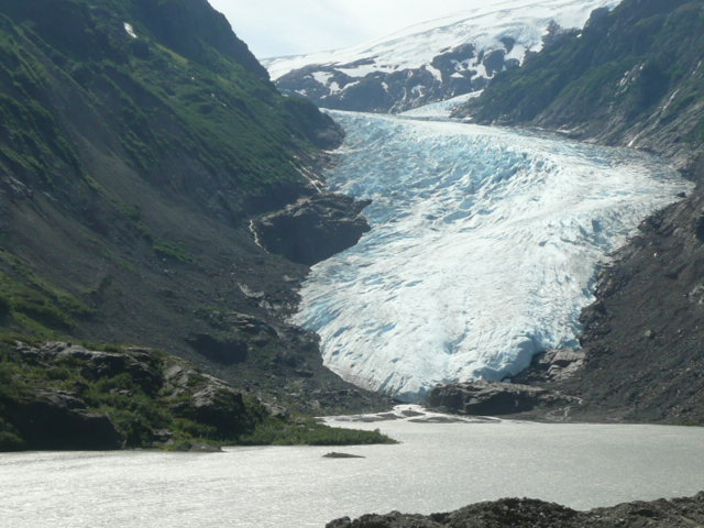
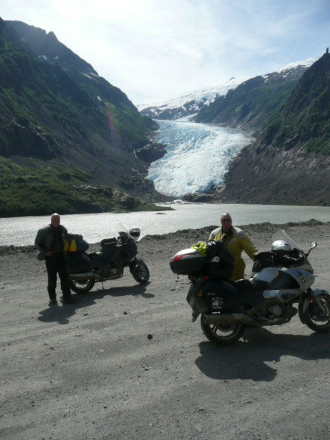
Bigger was Bear Glacier on the way into Stewart after Meziadin Junction:
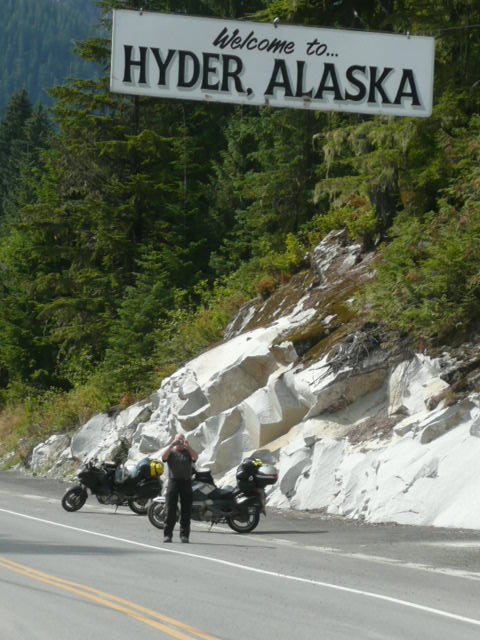
Another obligatory picture is the one at the Welcome to Hyder sign:
And today we stopped at Kitwanga Junction for another one of those obligatory pix:


And here’s one I took on our way out Stewart this morning:

I should have stopped and took a picture of the falls yesterday afternoon when there wasn’t fog obscuring the top half of the waterfall. Oh, well…
BTW, if you take a look at my Spotwalla link, look at the track through the canyon on the way out of Stewart this morning. There are a few spots that aren’t on the road. Believe me I didn’t leave the road, either on the way in or on the way out of Stewart. But I noticed on the way in that my elevation, according to my GPS, went from 1100-1200 feet at Bear Glacier up to over 8,000 feet a few miles farther down the road. And my max speed jumped to something like 387 mph in the same area. By the time we got to the streets of Stewart, it was showing accurate velocity and elevation information. That’s the 2nd time on the trip that I’ve noticed that the GPS has lost the signal, and I’m sure that the SPOT had the same problems.
Whistler, BC, tomorrow.
If my clothes ever get dry. And if I get up in the morning. And…
OK, I’m up and thought I’d add stats and one other comment. The comment first: KathyL, am NT-Owners Forum member from Australia had done me the favor of finding a headlight protector in Oz and sending it to me a year or so ago. Somewhere between Dease Lake and Stewart on one of the stretches of road construction, it performed its duty in a sacrificial way, shattering under the impact of a rock, but protecting the expensive and probably unavailable in the US headlight. When my old Concours needed a headlight (not the bulbs, folks, but the part the bulbs go in), it cost $422 and took a month for the dealer to get into his store. And the Connie had been in production for about 20 years at the time. I hope to avoid any other rocks to the headlight!
Stats:
Wednesday – Whitehorse to Dease Lake: Day, 431 miles
Thursday – Dease Lake to Stewart: Day, 277 miles
Friday: Stewart to Prince George: Day, 441 miles
Trip: 7,432 miles Year: 13,321 miles
Which moves me up to 3rd on the NT-Owners Forum’s yearly mileage tracker. Wahoo!

Recent Comments